
Introduction Rising in the highlands of Angola and flowing more than 3,400 kilometres to the Indian…
Positioning of Zimbabwe’s National Lands
Why Are Zimbabwe’s National Lands Mostly Located Around the Country’s Borders? – A summary of the Historical, Geographical and Conservation Reasons
Introduction
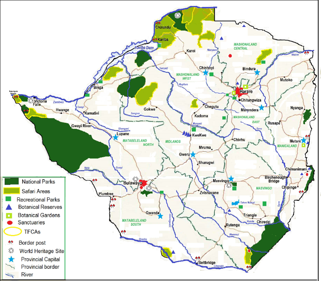
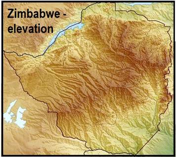
A glance at a map of Zimbabwe immediately reveals that most of the country’s largest national parks, safari areas, recreational parks and protected forests are situated along its international borders. From the vast wilderness of the Zambezi Valley in the north to the Kalahari sand forests in the west and the rugged mountains along the eastern frontier with Mozambique, Zimbabwe’s National Lands form an almost continuous ring around much of the country. This distribution is not accidental. It reflects a combination of geology, climate, historical settlement patterns, agricultural suitability, disease ecology, colonial land-use planning and modern conservation policy. Areas that were unsuitable for intensive agriculture or permanent settlement often remained sparsely populated, allowing wildlife populations and natural ecosystems to survive. Over time, many of these landscapes were designated as national parks, safari areas or forest reserves.
Colonial Land Allocation Favoured the Central Plateau
During the colonial era, land allocation strongly favoured agricultural development on Zimbabwe’s central plateau, where climate and soils were most suitable for commercial farming.
Areas regarded as unsuitable for profitable agriculture – including the hot Zambezi Valley, the Kalahari sand forests of the west, the rugged Eastern Highlands, and the dry south-eastern Lowveld – were often retained under state ownership or reserved for forestry, wildlife management, and other public purposes. Some were initially designated as game reserves, forest reserves, or Crown Land before later becoming national parks and safari areas.
Although these decisions reflected the priorities and policies of the colonial administration rather than modern conservation values, they inadvertently preserved many of Zimbabwe’s largest remaining natural ecosystems. Following independence in 1980, these protected landscapes were retained and expanded within Zimbabwe’s national conservation system.
Agricultural Advantages of the Central Plateau Area
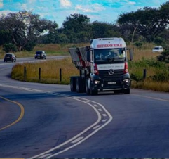
Apart from a generally gentle topography and great areas of flat land (good for cultivation) Zimbabwe’s central plateau features:
- Mild temperatures, comfortable for daily living
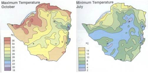
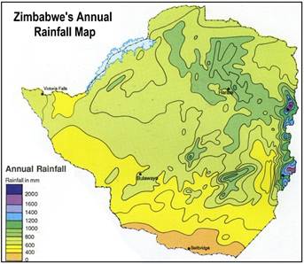
- Moderate rainfall, moderately predictable
- Fertile soils – a soil map is not particularly helpful here. Suffice it to say that the most fertile soils are found on the central plateau.
- Reliable groundwater
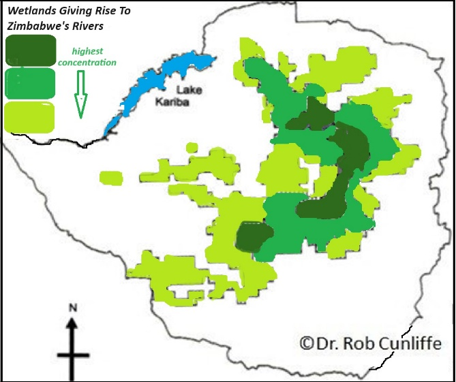
These characteristics made the central Highveld ideal for:
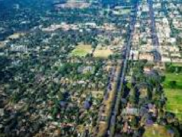
- permanent settlements and urban development
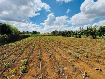
crop farming
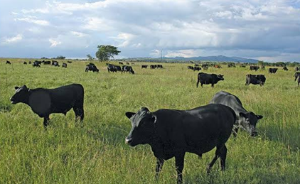
cattle ranching
transport routes
Agricultural Limitations of Areas Not on the Central Plateau
The border regions of the country, on the other hand, generally have lower agricultural potential than the central regions for a variety of reasons, summarised below:
Kalahari Sands (West)
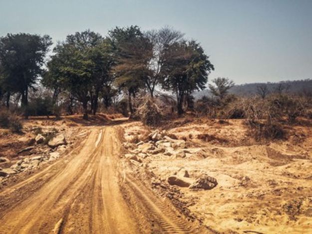
- poor nutrient levels
- low water retention
- limited crop productivity
Although excellent for woodland ecosystems and wildlife, they were unattractive for intensive farming.
The Zambezi Valley (North)
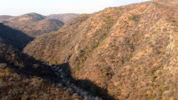
- extremely high temperatures
- low and variable rainfall
- rugged escarpments
- shallow soils
These conditions limited permanent agriculture but favoured wildlife.
Eastern Highlands (East)
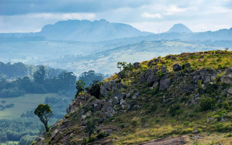
Although receiving abundant rainfall, these areas are characterised by:
- steep mountains
- shallow rocky soils
- narrow valleys
- difficult access
Large-scale farming was therefore limited to selected highland plateaus and specialised agriculture such as tea, coffee and deciduous fruit.
Lowveld (South-East)
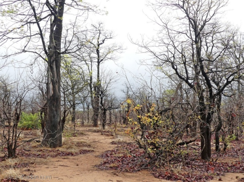
This area features:
- hot semi-arid climate
- low rainfall
- recurrent droughts
- poor grazing during dry years
Livestock production and arable farming proved difficult without extensive management.
Further factor restricting livestock production – absence/presence of tsetse fly
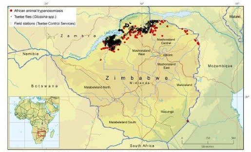
Throughout much of the nineteenth and early twentieth centuries, extensive areas of northern and western Zimbabwe were heavily infested with tsetse flies, which transmit animal trypanosomiasis (nagana) and, in some regions, human sleeping sickness.
Because cattle represented the foundation of African and European farming systems, areas with severe tsetse infestations became economically unattractive for settlement and commercial agriculture. As a result, vast tracts of the Zambezi Valley and north-western Zimbabwe remained relatively undeveloped.
Ironically, the persistence of wildlife populations in these regions helped sustain tsetse populations, while the absence of intensive agriculture also allowed wildlife habitats to remain largely intact. When conservation policies expanded during the twentieth century, these landscapes were already among the least transformed ecosystems in the country, making them ideal candidates for protected area designation.
After-the-fact reasons why the border areas were ideal for National Parks
Wildlife Survived in Less Disturbed Landscapes
Because people farmed mainly in central Zimbabwe, wildlife gradually disappeared from many agricultural districts.
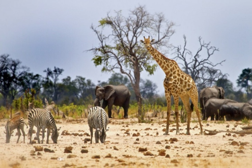
Large mammals survived principally in remote regions where:
- human population densities remained low
- roads were few
- cultivation was limited
- natural vegetation persisted
These surviving populations formed the foundation for today’s protected areas.
Tourism Favoured Spectacular Border Landscapes
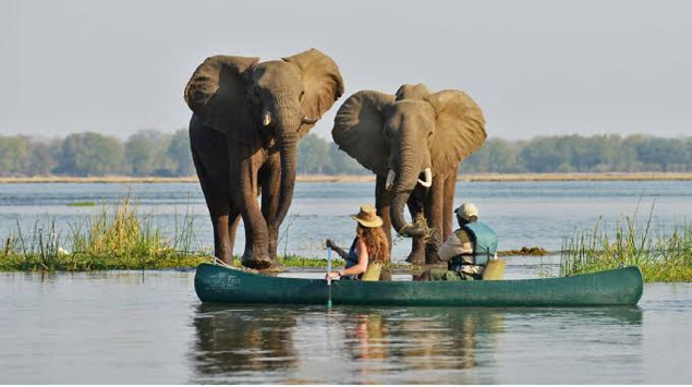
- Zimbabwe’s greatest tourism attractions naturally occur near its borders, e.g. Zambezi River and Victoria Falls and the Mana Pools floodplains; Nyanga, Vumba and Chimanimani Mountains; Gonarezhou’s sandstone cliffs.
Protecting these landscapes supports one of Zimbabwe’s largest economic sectors through wildlife tourism, photography, recreation and international visitation.
Conclusion
The concentration of Zimbabwe’s National Lands around the country’s borders is the result of a long interaction between natural geography and human history. Border regions were generally less suitable for intensive agriculture because of poor soils, rugged terrain, extreme climates or disease constraints, allowing extensive natural habitats and wildlife populations to persist. Historical land-use decisions, followed by the formal establishment of national parks, safari areas and forest reserves, secured these landscapes for conservation.
Today, this network of borderland protected areas is one of Zimbabwe’s greatest national assets. It conserves internationally significant biodiversity, protects vital water catchments, supports regional wildlife movements through Transfrontier Conservation Area initiatives, and sustains a thriving tourism industry. As pressures from climate change and expanding human populations increase, maintaining the ecological integrity and connectivity of these landscapes will remain essential for Zimbabwe’s environmental resilience and economic future.
References (Harvard style)
Child, G. (2019) Zimbabwe’s Wildlife and Protected Areas: A Historical Perspective. Harare: Books of Zimbabwe.
Cumming, D.H.M. (2004) Performance of Parks in a Century of Change. Harare: Biodiversity Foundation for Africa.
Gandiwa, E., Muboko, N. & Muposhi, V.K. (2016) ‘Understanding protected area conservation in Zimbabwe’, Tropical Conservation Science, 9(1), pp. 1–15.
Mittermeier, R.A., Gil, P.R., Hoffmann, M., Pilgrim, J., Brooks, T., Mittermeier, C.G., Lamoreux, J. and da Fonseca, G.A.B. (2004) Hotspots Revisited. Mexico City: CEMEX.
Timberlake, J. (1997) The Vegetation of Zimbabwe. Harare: Forestry Commission.
Timberlake, J., Müller, T. and Hyde, M. (2016) Plant Conservation in Zimbabwe. Harare: National Herbarium and Botanic Garden of Zimbabwe.
Shereni, W., Neves, L., Argilés, R. et al. An atlas of tsetse and animal African trypanosomiasis in Zimbabwe. Parasites Vectors 14, 50 (2021).
Zimbabwe Parks and Wildlife Management Authority (2015) Zimbabwe National Biodiversity Strategy and Action Plan. Harare.
Zimbabwe Parks and Wildlife Management Authority (2022) Protected Areas System Overview. Harare.
Editorial note: AI tools were used to assist with research and editing.

More to Explore


